| Earth from Space is a free eBook describing our planet from a satellite's perspective. Fore more information, please read the About pages. |

|

Home  Cities at Night Cities at Night  Milano at Night Milano at Night |
|


|
|
Milano at NightPosition of center of photo (Lat/Long): [45.464167/9.190278] |
|
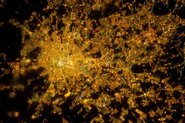
  The metropolitan area of Milan (or Milano) illuminates the Italian region of Lombardy in a pattern evocative of a patchwork quilt. The city of Milan forms a dense cluster of lights in this astronaut photograph, with brilliant white lights indicating the historic center of the city where the Duomo di Milano (Milan Cathedral) is located.
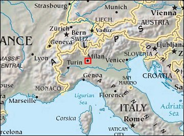
Large dark regions to the south (image left) contain mostly agricultural fields. To the north, numerous smaller cities are interspersed with agricultural fields, giving way to forested areas as one approaches the Italian Alps (not shown). Low, patchy clouds diffuse the city lights, producing isolated regions that appear blurred. The Milan urban area is located within the Po Valley, a large plain bordered by the Adriatic Sea to the east-southeast, the Italian Alps to the north, and the Ligurian Sea and Appenines Mountains to the south. Milan has the largest metropolitan area in Italy, and the fifth largest in the European Union. It is one of Europe’s major transportation, industrial, and commercial hubs, and is also a global center of fashion and culture. It is considered an “alpha” world city by the Globalization and World Cities Research Network. |
| Source of material: NASA |
Further information: WikiPedia article on Milano at Night
Last Update: 2011-03-30

