| Earth from Space is a free eBook describing our planet from a satellite's perspective. Fore more information, please read the About pages. |

|
Home  Europe Spain Canary Islands Europe Spain Canary Islands |
|
| See also: Mount Teide, Madeira | |


|
  |
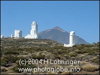
Canary IslandsPosition of center of photo (Lat/Long): [28.06090/-14.51703] |
|
  A thick pall of sand and dust blew out from the Sahara Desert over the Atlantic Ocean yesterday (January 6, 2002), engulfing the Canary Islands (Spain) in what has become one of the worst sand storms ever recorded there. A thick pall of sand and dust blew out from the Sahara Desert over the Atlantic Ocean yesterday (January 6, 2002), engulfing the Canary Islands (Spain) in what has become one of the worst sand storms ever recorded there.
|
| Source of material: NASA PhotoGlobe Pictures: Tenerife |
Further information: WikiPedia article on Canary Islands
Last Update: 2011-03-30