| Earth from Space is a free eBook describing our planet from a satellite's perspective. Fore more information, please read the About pages. |

|

Home  North America North America  USA USA  Massachusetts Massachusetts  Sandy Neck, Cape Cod Sandy Neck, Cape Cod |
|


|
|
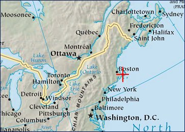
Sandy Neck, Cape CodPosition of center of photo (Lat/Long): [41.688/-70.296] |
|
  Land, sea, and air all meet along the coastline, and this intersection makes for some of the planetís most compelling visual and scientific landscapes. But for all of their beauty, coastal regions are also among the most beautifully complex to study, particularly with satellites.
This natural-color image of Sandy Neck and Barnstable Harbor, on the north side of Cape Cod, Massachusetts (United States), was acquired on November 4, 2005. The barrier beach - which started forming about 4,000 years ago - is covered by hardy coastal shrubs and trees, with sand dunes standing tens of feet tall. The back bay is shallow and surrounded by marsh, though a dredged channel descends anywhere from 2 to 6 meters deep. Not far offshore, near the top of the image, water depths reach roughly 12 meters. Satellite sensors can trace the shoreline and see the shallow bottom of some bays. They can trace oil and pollution slicks. They can detect the sediments - the sands, river mud, decaying organic matter, and even floating phytoplankton - drifting on or near the water surface. But in this turbid, colorful soup near the shore, it is hard for satellites to tell which ingredient is which. |
| Source of material: NASA |
Further information: WikiPedia article on Sandy Neck, Cape Cod
Last Update: 2011-03-30

