| Earth from Space is a free eBook describing our planet from a satellite's perspective. Fore more information, please read the About pages. |

|

Home  North America North America  USA USA  Texas Texas  El Paso El Paso |
|
| See also: Tucson | |


|
|
El PasoPosition of center of photo (Lat/Long): [31.76343/-106.43903] |
|
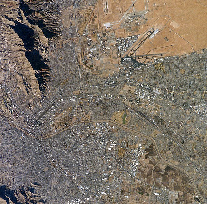
  The Rio Grande River can be seen meandering through the area, forming the boundary between the sister cities of El Paso, Texas (United States), and Juárez, Chihuahua (Mexico). The setting sun has cast the east side of the Sierra Juárez and Franklin Mountains into shadow. The Rio Grande River can be seen meandering through the area, forming the boundary between the sister cities of El Paso, Texas (United States), and Juárez, Chihuahua (Mexico). The setting sun has cast the east side of the Sierra Juárez and Franklin Mountains into shadow.
El Paso is a vibrant blend of cultures, the city's history spans more than 400 years blending Native American, Mexican, Spanish and the American Cowboy into one culture. In 1581, Spanish explorers reached the Rio Grande River and viewed a pass between the two mountain ranges rising out of the desert, naming it El Paso del Norte (the Pass of the North). Nowadays, with over 2 million inhabitants, El Paso and its sister city, Ciudad Juarez, form the largest metropolitan area in the world which includes a national border. In fact, 76.6% of the population of El Paso are Hispanic. The special relationship between El Paso and its sister city of Ciudad Juarez means that El Paso's economy is especially sensitive to border disruptions and the value of the Mexican currency. |
| Source of material: NASA |
Further information: WikiPedia article on El Paso
Last Update: 2011-03-30

