| Earth from Space is a free eBook describing our planet from a satellite's perspective. Fore more information, please read the About pages. |

|

Home  North America North America  USA USA  Utah Utah  Great Salt Lake Great Salt Lake |
|
| See also: Lake Sambhar | |


|
|
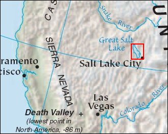
Great Salt LakePosition of center of photo (Lat/Long): [41.21916/-112.45236] |
|
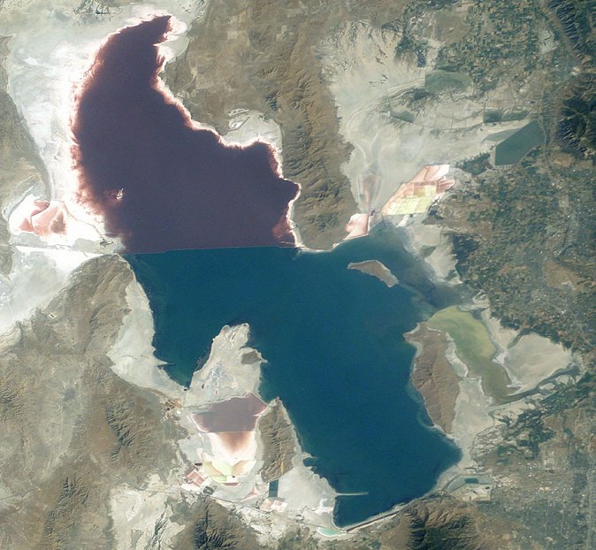
  Great Salt Lake serves as a striking visual marker for astronauts orbiting over North America. A sharp line across its center is caused by the restriction in water flow from the railroad causeway. The eye-catching colors of the lake stem from the fact that Great Salt Lake is hypersaline, typically 3-5 times saltier than the ocean, and the high salinities support sets of plants and animals that affect the light-absorbing qualities of the water. North of the causeway salinities are higher, and the water turns red from the pigments of halophilic bacteria. In the shallower corners of the lake, earthen dikes mark large salt evaporation works, which take on the jewel tones of turquoise, russet, amber, and pearl white. Great Salt Lake serves as a striking visual marker for astronauts orbiting over North America. A sharp line across its center is caused by the restriction in water flow from the railroad causeway. The eye-catching colors of the lake stem from the fact that Great Salt Lake is hypersaline, typically 3-5 times saltier than the ocean, and the high salinities support sets of plants and animals that affect the light-absorbing qualities of the water. North of the causeway salinities are higher, and the water turns red from the pigments of halophilic bacteria. In the shallower corners of the lake, earthen dikes mark large salt evaporation works, which take on the jewel tones of turquoise, russet, amber, and pearl white.
The detailed image shows some of the salt works operated by Great Salt Lake Minerals and Chemicals Corporation near West Warren, Utah, on the eastern shore of the lake. Evaporative salt harvesting at Great Salt Lake is an important source of minerals for industrial uses. The lake contains an estimated 5 billion tons of salt, with 2.5 million additional tons washing in each year. Extraction rates are slightly higher than the amount added to the lake each year. In addition to sodium chloride, the ponds near West Warren are used to extract potassium sulfate and magnesium chloride, which are used to make fertilizers. |
| Source of material: NASA |
Further information: WikiPedia article on Great Salt Lake
Last Update: 2011-03-30

