| Earth from Space is a free eBook describing our planet from a satellite's perspective. Fore more information, please read the About pages. |

|

Home  Asia Asia  Mongolia Mongolia  Har Nuur Har Nuur |
|
| See also: Uuregnuur | |


|
|
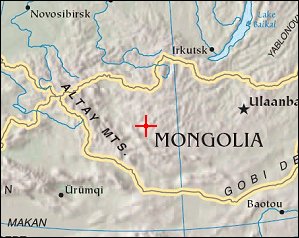
Har NuurPosition of center of photo (Lat/Long): [48.35720/96.10479] |
|
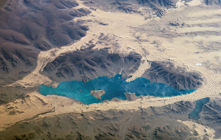
  Har Nuur ("Black Lake") is located in western Mongoliaís Valley of Lakes, part of a system of closed basins stretching across central Asia. These basins are the remnants of larger paleolakes (paleo- means "ancient") that began to shrink approximately five thousand years ago as regional climate became drier. Like other lakes in the region, Har Nuur relies on precipitation, growing in the spring and shrinking in the summer. This process of growth and shrinkage produces a variety of wetland habitats, as well as resting points for large numbers of migratory birds. Har Nuur ("Black Lake") is located in western Mongoliaís Valley of Lakes, part of a system of closed basins stretching across central Asia. These basins are the remnants of larger paleolakes (paleo- means "ancient") that began to shrink approximately five thousand years ago as regional climate became drier. Like other lakes in the region, Har Nuur relies on precipitation, growing in the spring and shrinking in the summer. This process of growth and shrinkage produces a variety of wetland habitats, as well as resting points for large numbers of migratory birds.
|
| Source of material: NASA |
Further information: WikiPedia article on Har Nuur
Last Update: 2011-03-30


