| Earth from Space is a free eBook describing our planet from a satellite's perspective. Fore more information, please read the About pages. |

|

Home  Australia and Oceania Australia and Oceania  Papua New Guinea Papua New Guinea  New Britain New Britain |
|
| See also: Bouganville Island, Ahus Island | |


|
|
New BritainPosition of center of photo (Lat/Long): [-5.75111/150.64055] |
|
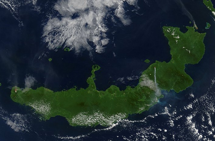
  The troublesome trio on Papua New Guinea’s West New Britain erupted simultaneously on August 9, 2005. Langila, Ulawun, and Rabaul Volcanoes all spewed ash at the same time, though not all with the same results. The troublesome trio on Papua New Guinea’s West New Britain erupted simultaneously on August 9, 2005. Langila, Ulawun, and Rabaul Volcanoes all spewed ash at the same time, though not all with the same results.
The Moderate Resolution Imaging Spectroradiometer (MODIS), flying on NASA’s Terra satellite captured this image of the island of New Britain. The westernmost volcano, Langila, and the easternmost volcano, Rabaul, send fairly faint plumes of ash into the air, both of which drift toward the northwest. Ulawun, the most active volcano in this picture, spits out a dense stream of ash that flows straight south. The volcanoes’ proximity to each other and propensity for acting up at the same time suggest that they could be affected by the same tectonic activity underground. |
| Source of material: NASA |
Further information: WikiPedia article on New Britain
Last Update: 2011-03-30

