| Earth from Space is a free eBook describing our planet from a satellite's perspective. Fore more information, please read the About pages. |

|

Home  Australia and Oceania Australia and Oceania  New Zealand New Zealand  New Zealand New Zealand |
|


|
|
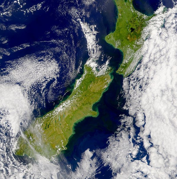
Runoff from Flooding in New ZealandPosition of center of photo (Lat/Long): [-42.09692/172.70262] |
|
  This SeaWiFS image captured on January 21, 2002 shows the turbid water along the South Island's eastern shore. The turbidity is a result of the recent heavy flooding in the area. This SeaWiFS image captured on January 21, 2002 shows the turbid water along the South Island's eastern shore. The turbidity is a result of the recent heavy flooding in the area.
|
| Source of material: NASA |
Further information: WikiPedia article on Runoff from Flooding in New Zealand
Last Update: 2011-03-30

