| Earth from Space is a free eBook describing our planet from a satellite's perspective. Fore more information, please read the About pages. |

|

Home  South America South America  Brazil Brazil  Perdizes Perdizes |
|


|
|
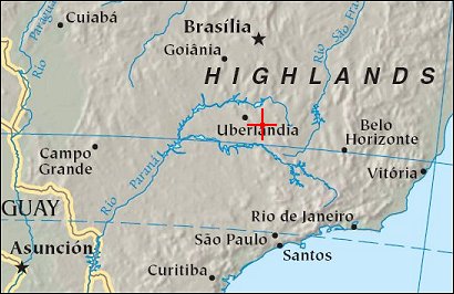
Perdizes (Minas Gerais)Position of center of photo (Lat/Long): [-19.38/-47.39] |
|
  Text....
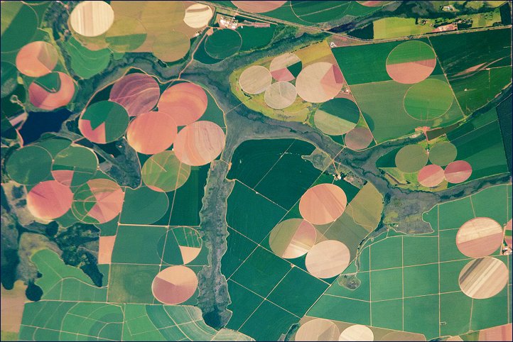
This astronaut photograph illustrates the diverse agricultural landscape in the western part of Minas Gerais state in Brazil. Though most widely known for its mineral wealth, Minas Gerais is also a large agricultural producer for Brazil. Text....
This astronaut photograph illustrates the diverse agricultural landscape in the western part of Minas Gerais state in Brazil. Though most widely known for its mineral wealth, Minas Gerais is also a large agricultural producer for Brazil.
The fields in this image are located southwest of the city of Perdizes, which means "partridges" in Portuguese. A mix of regularly-gridded polygonal fields and circular center-pivot fields marks the human use of the region. Small streams (and their adjacent floodplains) of the Araguari River extend like fingers throughout the landscape. The visual diversity of the field forms is matched by the variety of crops: sunflowers, wheat, potatoes, coffee, rice, soybeans, and corn are among the products of the region. While the Northern Hemisphere is still in the grip of winter, crops are growing in the Southern Hemisphere, as indicated by the many green fields. Fallow fields - not in active agricultural use - display the violet, reddish, and light tan soils common to this part of Brazil. Darker soils are often rich in iron and aluminum oxides, and are typical of highly weathered soil that forms in hot, humid climates. |
| Source of material: NASA |
Further information: WikiPedia article on Perdizes (Minas Gerais)
Last Update: 2011-03-30

