| Earth from Space is a free eBook describing our planet from a satellite's perspective. Fore more information, please read the About pages. |

|

Home  North America North America  Mexico Mexico  Pico de Orizaba Pico de Orizaba |
|
| See also: Popocatépetl | |


|
|
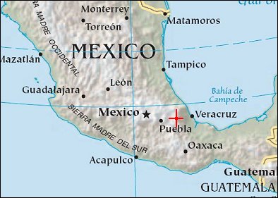
Pico de OrizabaPosition of center of photo (Lat/Long): [19.03/-97.27] |
|
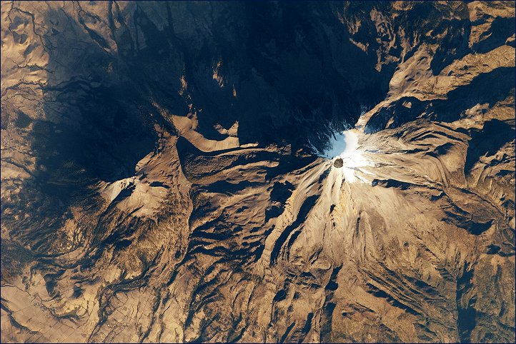
  The snow- and ice-clad peak of Pico de Orizaba (also known as Citlaltépetl) boasts a summit elevation of 5,675 meters (18,620 feet) above sea level, making it both the highest peak in Mexico and the tallest volcano in North America. It is also one of three volcanic peaks in Mexico - together with Popocatépetl and Iztaccíhuatl - that retain summit glaciers. Pico de Orizaba is part of the Trans-Mexican Volcanic Belt that extends roughly east-west across Mexico. The last recorded eruption took place in 1846. While the volcano is considered dormant at present, geologists continue to investigate the potential hazards associated with a renewal of activity.
Shadows accentuate several features of the Pico de Orizaba, a stratovolcano, visible in this astronaut photograph from the International Space Station. The 300-meter-deep summit crater is clearly visible against surrounding ice and snow cover near image center. Several lava flows extend down the flanks of the volcano, made readily visible by prominent cooling ridges along their sides known as flow levees. One of the most clearly visible examples is located on the southwest flank of the cone. The extinct Sierra Negra volcano to the southwest has a summit elevation of 4,640 meters above sea level; while not as lofty as Pico de Orizaba, it is also one of Mexico’s highest peaks. |
| Source of material: NASA |
Further information: WikiPedia article on Pico de Orizaba
Last Update: 2011-03-30

