| Earth from Space is a free eBook describing our planet from a satellite's perspective. Fore more information, please read the About pages. |

|

Home  Australia and Oceania Australia and Oceania  Australia Australia  Shark Bay Shark Bay |
|


|
|
Shark BayPosition of center of photo (Lat/Long): [-26.19336/113.31548] |
|
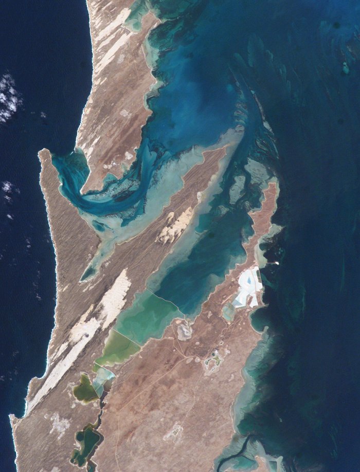
  This image shows large solar salt works developed in Useless Loop and Useless Inlet, Shark Bay, Western Australia. The salt (sodium chloride) is produced when ponds are repeatedly flooded with seawater, which is progressively concentrated by evaporation. This particular salt farm opened in 1967 and expanded operations in the 1990s. Today, this salt farm comprises over 50 ponds’the newest pond is the outermost pond in Useless Inlet, which provides the first evaporation cycle to increase the salinity of the water prior to entering the next pond. Complex chemical and biological adjustments occur in the system each time the configuration of ponds is changed. This image shows large solar salt works developed in Useless Loop and Useless Inlet, Shark Bay, Western Australia. The salt (sodium chloride) is produced when ponds are repeatedly flooded with seawater, which is progressively concentrated by evaporation. This particular salt farm opened in 1967 and expanded operations in the 1990s. Today, this salt farm comprises over 50 ponds’the newest pond is the outermost pond in Useless Inlet, which provides the first evaporation cycle to increase the salinity of the water prior to entering the next pond. Complex chemical and biological adjustments occur in the system each time the configuration of ponds is changed.
Solar salt production has increased along the world’s arid coastal regions. Global demand for salt is on the rise, primarily because salt is a basic feedstock to the chemical industry (the largest salt consumer). Commercial solar salt ponds are frequently controversial components of coastal ecosystems. The hypersaline conditions are toxic to preexisting ecosystems in and around the converted land, and valuable coastal wetlands may be impacted by flooding, changing water levels and salinities. However, salt ponds have also been successfully converted to wetlands, and the shallow ponds can support shellfish and bird populations. |
| Source of material: NASA |
Further information: WikiPedia article on Shark Bay
Last Update: 2011-03-30

