| Earth from Space is a free eBook describing our planet from a satellite's perspective. Fore more information, please read the About pages. |

|

Home  Africa Africa  Somalia Somalia  Flooding in Somalia Flooding in Somalia |
|


|
|
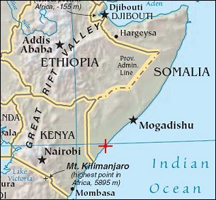
Flooding in SomaliaPosition of center of photo (Lat/Long): [-0.073333/42.815] |
|
  A weak El Niño weather pattern in the tropical Pacific Ocean created ripples in the world’s weather patterns in late 2006. El Niño is an episodic fluctuation in the tropical Pacific climate system that, among other consequences, causes equatorial regions around the globe to experience drought or abnormally wet conditions. The Horn of Africa frequently sees heavy precipitation during El Niño periods. Following this pattern, heavy rainfall and flooding has occurred over the region since October 2006. By late November 2006, southern Somalia and eastern Ethiopia were experiencing severe flooding that displaced hundreds of thousands of people. A weak El Niño weather pattern in the tropical Pacific Ocean created ripples in the world’s weather patterns in late 2006. El Niño is an episodic fluctuation in the tropical Pacific climate system that, among other consequences, causes equatorial regions around the globe to experience drought or abnormally wet conditions. The Horn of Africa frequently sees heavy precipitation during El Niño periods. Following this pattern, heavy rainfall and flooding has occurred over the region since October 2006. By late November 2006, southern Somalia and eastern Ethiopia were experiencing severe flooding that displaced hundreds of thousands of people.
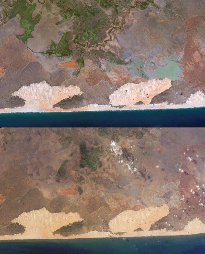
These two images show the same coastal region in Somalia, south of the capital of Mogadishu, providing a visual contrast between wet and normal conditions. The images were taken on February 14, 2007, during the wetter El Niño period (top), and December 2, 2005, during more normal conditions (bottom). The February 2007 image also shows the blooming of vegetation within swamps inland of coastal dune fields. Flooding of a coastal depression by overflowing rivers and swamps is also apparent. In early March 2007, the region was experiencing outbreaks of cholera and Rift Valley Fever associated with the flooding. |
| Source of material: NASA |
Further information: WikiPedia article on Flooding in Somalia
Last Update: 2011-03-30

