| Earth from Space is a free eBook describing our planet from a satellite's perspective. Fore more information, please read the About pages. |

|

Home  Africa Africa  Egypt Egypt  Cairo from Envisat Cairo from Envisat |
|
| See also: Nile Delta | |


|
|
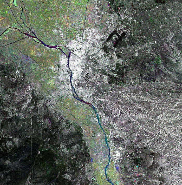
Cairo from EnvisatPosition of center of photo (Lat/Long): [30.07793/31.25421] |
|
  This Envisat ASAR Wide-Swath radar multicolour composite image is focused over the capital city of Cairo, Egypt, seen as a large bright area centre left of the image. The River Nile crosses the image from south to north separating the Libyan Desert or Western Desert, a part of the Sahara, (west) from the Arabian Desert (east). This Envisat ASAR Wide-Swath radar multicolour composite image is focused over the capital city of Cairo, Egypt, seen as a large bright area centre left of the image. The River Nile crosses the image from south to north separating the Libyan Desert or Western Desert, a part of the Sahara, (west) from the Arabian Desert (east).
From the image it is noticeable that the only fertile territories are along the valley of the River Nile and the Nile Delta (upper left portion of the image). Also visible are the Cairo International Airport, northeast of Cairo (two thick black lines) and three of Egypt's most famous pyramids, the Great Pyramid of Khufu, or Cheops, and the Khafre and Menkaure pyramids, which may be observed in the southwestern suburb of Cairo, Giza (in full size mode). The image is made of three ASAR images acquired on different dates and assigning a colour (RGB) to each date. |
| Source of material: ESA |
Further information: WikiPedia article on Cairo from Envisat
Last Update: 2011-03-30

