| Earth from Space is a free eBook describing our planet from a satellite's perspective. Fore more information, please read the About pages. |

|

Home  North America North America  Mexico Mexico  Guadalupe Island Guadalupe Island |
|
| See also: Baja California | |


|
|
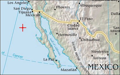
Guadalupe IslandPosition of center of photo (Lat/Long): [28.8833/-118.3] |
|
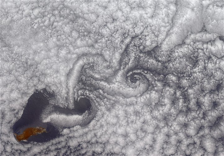
  These Multi-angle Imaging Spectroradiometer (MISR) images from June 11, 2000 demonstrate a turbulent atmospheric flow pattern known as the von Karman vortex street. This phenomenon is named after aerodynamicist Theodore von Karman, who theoretically derived the conditions under which it occurs. The alternating double row of vortices can form in the wake of an obstacle, in this instance the eastern Pacific island of Guadalupe (Mexico). The rugged terrain of this volcanic Mexican island reaches a maximum elevation of 1.3 kilometers. The island is about 35 kilometers long and is located 260 kilometers west of Baja California. These Multi-angle Imaging Spectroradiometer (MISR) images from June 11, 2000 demonstrate a turbulent atmospheric flow pattern known as the von Karman vortex street. This phenomenon is named after aerodynamicist Theodore von Karman, who theoretically derived the conditions under which it occurs. The alternating double row of vortices can form in the wake of an obstacle, in this instance the eastern Pacific island of Guadalupe (Mexico). The rugged terrain of this volcanic Mexican island reaches a maximum elevation of 1.3 kilometers. The island is about 35 kilometers long and is located 260 kilometers west of Baja California.
The vortex pattern is made visible by the marine stratocumulus clouds around Guadalupe Island. The image is a color view obtained by MISR's vertical- viewing (nadir) camera. North is toward the left. The orientation of the vortex street indicates that the wind direction is from lower left to upper right (northwest to southeast). The areas within the vortex centers tend to be clear because the rotating motions induce a vertical wind component that can break up the cloud deck. Theodore von Karman was a Professor of Aeronautics at Caltech and Director of Caltech's Guggenheim Aeronautical Laboratory from 1930-1949. He was one of the principal founders of the Jet Propulsion Laboratory. |
| Source of material: NASA |
Further information: WikiPedia article on Guadalupe Island
Last Update: 2011-03-30

