| Earth from Space is a free eBook describing our planet from a satellite's perspective. Fore more information, please read the About pages. |

|

Home  Africa Africa  Republic of the Congo Republic of the Congo  Kinshasa and Brazzaville Kinshasa and Brazzaville |
|
| See also: Wembo-Nyama | |


|
|
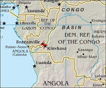
Kinshasa and BrazzavillePosition of center of photo (Lat/Long): [-4.26668/15.33877] |
|
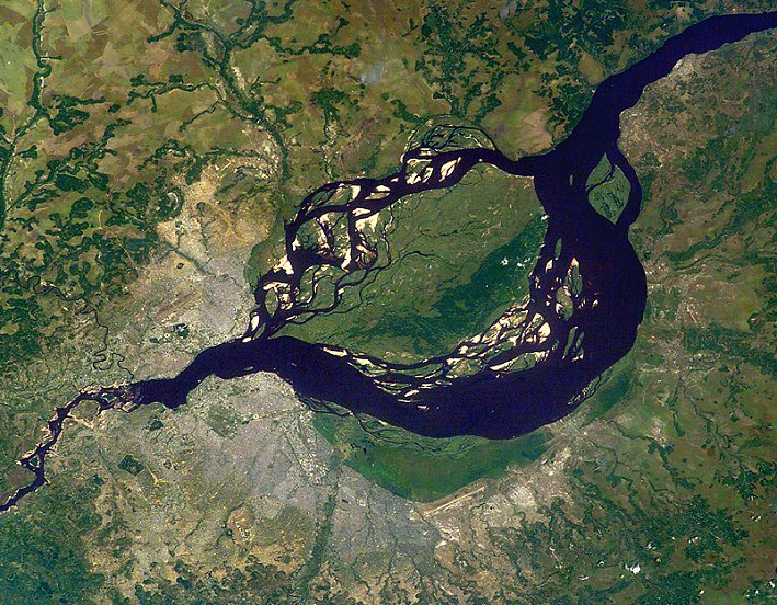
  This image, taken from the International Space Station on June 6, 2003, shows two capital cities on opposite banks of the Congo River. The smaller city is Brazzaville on the north side of the river, and Kinshasa on the south side. The cities lie at the downstream end of an almost circular widening in the river known as Stanley Pool. The international boundary follows the south shore of the pool (roughly 30 km in diameter). This image, taken from the International Space Station on June 6, 2003, shows two capital cities on opposite banks of the Congo River. The smaller city is Brazzaville on the north side of the river, and Kinshasa on the south side. The cities lie at the downstream end of an almost circular widening in the river known as Stanley Pool. The international boundary follows the south shore of the pool (roughly 30 km in diameter).
The Republic of the Congo, originally a French colony, is sometimes called Congo-Brazzaville - as opposed to the Democratic Republic of the Congo (known from 1971 to 1999 as Zaire) which is often called Congo-Kinshasa, originally a Belgian colony. Brazzaville has a population of 600,000, compared with Kinshasa’s 6.8 million. Kinshasa’s population has more than doubled in 20 years - 2.7 million in 1984 and 6.8 million in 2004. Kinshasa is thus now far larger than the entire Congo-Brazzaville republic, which has a population of almost 3 million. There is no bridge between the cities so that water craft of many kinds ply between them. It is not uncommon to see dugout canoes being paddled between the cities. The Congo River drains the vast equatorial Congo Basin, and discharges 35,000-40,000 cubic meters per second of water at Stanley Pool (by comparison, the Nile River discharges 2,500-3,500 cubic meters per second at Aswan). The Congo River exits the pool through a markedly narrowed channel at a series of whitewater rapids that can be seen in this view from space. |
| Source of material: NASA |
Further information: WikiPedia article on Kinshasa and Brazzaville
Last Update: 2011-03-30

