| Earth from Space is a free eBook describing our planet from a satellite's perspective. Fore more information, please read the About pages. |

|

Home  South America South America  Argentina Argentina  Patagonia and Falkland Islands Patagonia and Falkland Islands |
|
| See also: Tierra del Fuego, Fires on East Falkland Island, Glacial Lakes of Patagonia | |


|
|
Patagonia and Falkland IslandsPosition of center of photo (Lat/Long): [-48.94033/-63.91721] |
|
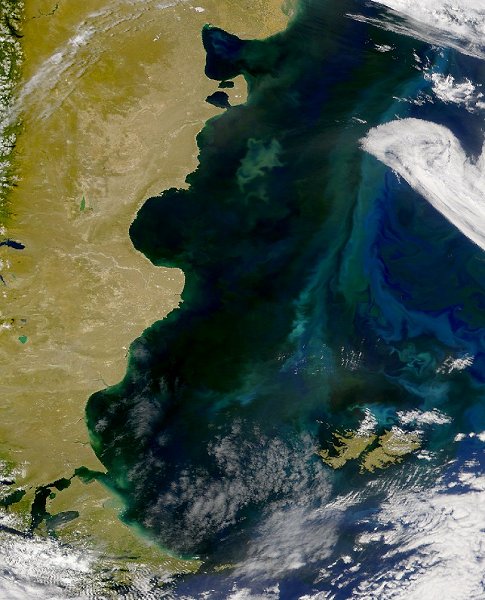
  Here is yet another view of the riot of color in the waters off the coast of Argentina. This SeaWiFS image collected on December 11, 2001 shows various large phytoplankton blooms in the waters of the south Atlantic Ocean. Here is yet another view of the riot of color in the waters off the coast of Argentina. This SeaWiFS image collected on December 11, 2001 shows various large phytoplankton blooms in the waters of the south Atlantic Ocean.
At the lower right one can see the Falkland Islands (Islas Malvinas), which have caused a war between UK and Argentina. UK continues to reject sovereignty talks requested by Argentina, whose constitution still claims UK-administered Falkland Islands (Islas Malvinas) and South Georgia and the South Sandwich Islands, but in 1995 ceded the right to settle the dispute by force. |
| Source of material: NASA |
Further information: WikiPedia article on Patagonia and Falkland Islands
Last Update: 2011-03-30

