| Earth from Space is a free eBook describing our planet from a satellite's perspective. Fore more information, please read the About pages. |

|

Home  South America South America  Chile Chile  Tierra del Fuego Tierra del Fuego |
|
| See also: Patagonia and Falkland Islands, Moreno Glacier, Cape Horn, Cape Horn - Detailed Map | |


|
|
Tierra del FuegoPosition of center of photo (Lat/Long): [-53.89685/-69.92091] |
|
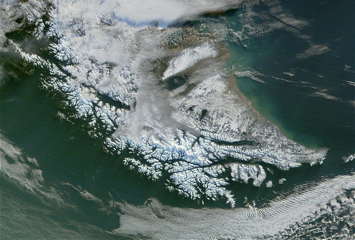
  This MODIS true-color image shows the Tierra del Fuego region of Argentina and Chile, located on the southernmost tip of South America. Tierra del Fuego (land of fires) is so named for the hundreds of fires that were seen on the beach which the Indians used to keep themselves warm and cook their main diet of mussels. As early as the beginning of the 18th century, an estimated 8000 Yagan Indians lived here. They paddled their flimsy Beech bark canoes out as far as the treacherous islands of Cape Horn and beyond.These nomads of the sea had lived here for perhaps ten thousand years. This MODIS true-color image shows the Tierra del Fuego region of Argentina and Chile, located on the southernmost tip of South America. Tierra del Fuego (land of fires) is so named for the hundreds of fires that were seen on the beach which the Indians used to keep themselves warm and cook their main diet of mussels. As early as the beginning of the 18th century, an estimated 8000 Yagan Indians lived here. They paddled their flimsy Beech bark canoes out as far as the treacherous islands of Cape Horn and beyond.These nomads of the sea had lived here for perhaps ten thousand years.
|
| Source of material: NASA |
Further information: WikiPedia article on Tierra del Fuego
Last Update: 2011-06-16

