| Earth from Space is a free eBook describing our planet from a satellite's perspective. Fore more information, please read the About pages. |

|

Home  Europe Europe  Spain Spain  Sierra Nevada Sierra Nevada |
|


|
|
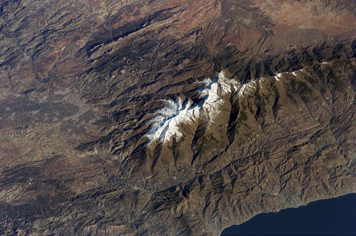
Sierra NevadaPosition of center of photo (Lat/Long): [37.06810/-3.39095] |
|
  The Sierra Nevada, part of the Betic Cordillera of southern Spain, were formed during the Alpine Orogeny, a mountain-building event that also formed the European Alps to the east and the Atlas Mountains of northern Africa across the Mediterranean Sea to the south. The Sierra as observed today formed during the Tertiary Period (65 to 1.8 million years ago) from the collision of the African and Eurasian continental plates. The former Tethys Sea also closed during this time period; the Mediterranean Sea is the largest surviving remnant basin of the ancient Tethys. The Sierra Nevada, part of the Betic Cordillera of southern Spain, were formed during the Alpine Orogeny, a mountain-building event that also formed the European Alps to the east and the Atlas Mountains of northern Africa across the Mediterranean Sea to the south. The Sierra as observed today formed during the Tertiary Period (65 to 1.8 million years ago) from the collision of the African and Eurasian continental plates. The former Tethys Sea also closed during this time period; the Mediterranean Sea is the largest surviving remnant basin of the ancient Tethys.
|
| Source of material: NASA |
Further information: WikiPedia article on Sierra Nevada
Last Update: 2011-03-30


