| Earth from Space is a free eBook describing our planet from a satellite's perspective. Fore more information, please read the About pages. |

|

Home  Europe Europe  Italy Italy  Strait of Messina Strait of Messina |
|


|
|
Strait of MessinaPosition of center of photo (Lat/Long): [38.21187/15.61067] |
|
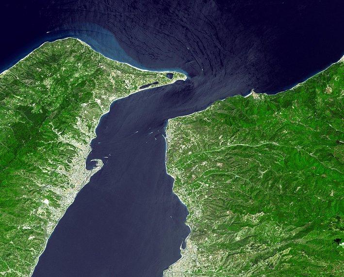
  The Strait of Messina Bridge Project, if completed, would stand as one of the Landmark Bridges of the 21st century. It would be the longest suspension bridge ever built. The Strait of Messina divides the island of Sicily from Calabria in southern Italy, and is 3 km wide. While the overall length is not a big problem the economics, water depth, wind, and earthquakes all have to be accounted for. To avoid the problem of the deep water, the solution was to design the longest suspension bridge ever. It will have a 3300 m main span and 180 m side spans (overall length 3.7 km). The main piers will be founded in 120 m of water. The wind will be no problem as the aerodynamic features of the bridge will allow it to withstand 216 km/hr. Earthquakes will have to be huge as the bridge will be able to face magnitude 7.1 earthquake without damage. The only obstacle left is the funding. The bridge is expected to cost five billion dollars and take eleven years to build. The bridge will be 60 m wide and will have 12 lanes for traffic and two lanes in the middle for trains. This will allow 140,000 vehicles and 200 trains per day. This will cut down transit times of up to 12 hours down to minutes. The ASTER image was acquired on June 14, 2002, and covers an area of 42.6 x 36.8 km. The image is centered at 38.2 degrees north latitude, 15.6 degrees east longitude. The Strait of Messina Bridge Project, if completed, would stand as one of the Landmark Bridges of the 21st century. It would be the longest suspension bridge ever built. The Strait of Messina divides the island of Sicily from Calabria in southern Italy, and is 3 km wide. While the overall length is not a big problem the economics, water depth, wind, and earthquakes all have to be accounted for. To avoid the problem of the deep water, the solution was to design the longest suspension bridge ever. It will have a 3300 m main span and 180 m side spans (overall length 3.7 km). The main piers will be founded in 120 m of water. The wind will be no problem as the aerodynamic features of the bridge will allow it to withstand 216 km/hr. Earthquakes will have to be huge as the bridge will be able to face magnitude 7.1 earthquake without damage. The only obstacle left is the funding. The bridge is expected to cost five billion dollars and take eleven years to build. The bridge will be 60 m wide and will have 12 lanes for traffic and two lanes in the middle for trains. This will allow 140,000 vehicles and 200 trains per day. This will cut down transit times of up to 12 hours down to minutes. The ASTER image was acquired on June 14, 2002, and covers an area of 42.6 x 36.8 km. The image is centered at 38.2 degrees north latitude, 15.6 degrees east longitude.
|
| Source of material: ASTER Science Team |
Further information: WikiPedia article on Strait of Messina
Last Update: 2011-03-30

