| Earth from Space is a free eBook describing our planet from a satellite's perspective. Fore more information, please read the About pages. |

|

Home  Europe Europe  Italy Italy  Sardinia Sardinia |
|
| See also: Corsica | |


|
|
SardiniaPosition of center of photo (Lat/Long): [40.20090/9.12184] |
|
  Sardinia, Italy, is one the earliest populated lands of Europe. Some ancient artifacts date human populations there as old as 6000 B.C. Around 1500 B.C., another group of settlers arrived on the island (historians don't know where they came from) and spread quickly across the island. Known as the Nuragic people, these settlers built almost 30,000 circular fortresses--called "nuraghe"-- around the island; each strategically located so that they were within eyesight of their nearest neighbors. Today, about 7,000 nuraghe ruins still stand, unlike any other ruins in the world. Sardinia, Italy, is one the earliest populated lands of Europe. Some ancient artifacts date human populations there as old as 6000 B.C. Around 1500 B.C., another group of settlers arrived on the island (historians don't know where they came from) and spread quickly across the island. Known as the Nuragic people, these settlers built almost 30,000 circular fortresses--called "nuraghe"-- around the island; each strategically located so that they were within eyesight of their nearest neighbors. Today, about 7,000 nuraghe ruins still stand, unlike any other ruins in the world.
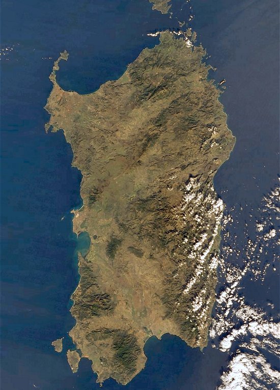
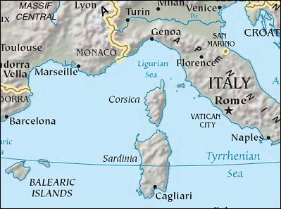
Sardinia is the second largest island in the Mediterranean, situated due west of mainland Italy. Stretching across the central, eastern part of Sardinia is the rugged terrain of Gennargentu--mountainous and thickly vegetated. Mostly uninhabited by people, the 50,000-hectare wilderness of Monte Arcosu is home to a unique population of fallow deer as well as wild boar, hares, foxes, golden eagles, and the Sardinian wildcat. Founded in the ninth century by Phoenicians, the port city of Cagliari sits on the large bay on Sardinia's southeastern coast. To the north lies the old city of Sassari (originally an ancient settlement called Tathari), situated on a hillside overlooking the large Gulf of Asinara. |
| Source of material: NASA |
Further information: WikiPedia article on Sardinia
Last Update: 2011-03-30

