| Earth from Space is a free eBook describing our planet from a satellite's perspective. Fore more information, please read the About pages. |

|
Home  Europe France Corsica Europe France Corsica |
|
| See also: Sardinia, Fjords of Norway | |


|
  |
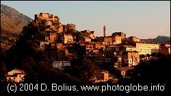
CorsicaPosition of center of photo (Lat/Long): [42.12805/9.09641] |
|
  Rich in antiquities and picturesque landscapes, the island province of Corsica, France, have captured the imaginations of historians and poets alike for centuries. Rich in antiquities and picturesque landscapes, the island province of Corsica, France, have captured the imaginations of historians and poets alike for centuries.
Corsica, crowned with snow-capped mountains, jeweled with shimmering lakes, and cloaked in misty emerald forests, is situated in the sapphire blue Mediterranean Sea southeast of mainland France. The island enjoys a relatively warm climate consisting of hot, dry summers full of sunshine, and mild winters that rarely dip below 0°C (32°F). In this scene, Corsica is the smaller island to the north. The island has almost 1,700 hills and mountains, ranging from 300 to over 2,700 meters in height. The tallest of these peaks is the snow-capped Monte Cinto toward the northern end of the island. Coursing throughout the island is an extensive network of rivers, carved into Corsica's granite face by snowmelt and rainwater runoff.
|
| Source of material: NASA |

Further information: WikiPedia article on Corsica
Last Update: 2011-03-30