| Earth from Space is a free eBook describing our planet from a satellite's perspective. Fore more information, please read the About pages. |

|

Home  South East Asia South East Asia  Indonesia Indonesia  Gleebruk - Tsunami Damage Gleebruk - Tsunami Damage |
|
| See also: Phuket | |


|
|
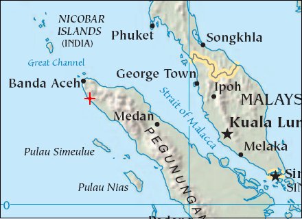
Gleebruk - Tsunami DamagePosition of center of photo (Lat/Long): [5.26833/95.245] |
|
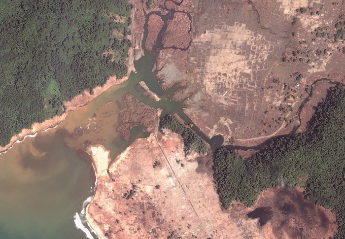
  The tsunami of December 26, 2004, struck hardest along the northwest coast of Sumatra, in Indonesia’s Aceh province. In places only 100 kilometers (62 miles) from the earthquake epicenter, the Aceh coast was drowned in waves up to 15 meters (50 feet) tall. The water was channeled inland through low-lying areas, such as stream floodplains. The tsunami of December 26, 2004, struck hardest along the northwest coast of Sumatra, in Indonesia’s Aceh province. In places only 100 kilometers (62 miles) from the earthquake epicenter, the Aceh coast was drowned in waves up to 15 meters (50 feet) tall. The water was channeled inland through low-lying areas, such as stream floodplains.
These images of Gleebruk, a small town located roughly 50 km (31 miles) from Banda Aceh, show the degree of destruction. Wooded hills in the upper left of the images were spared, while the wave scoured the area alongside the stream in the center of the image. Buildings, trees, roads, bridges, beaches - and even topsoil - were swept away by the force of the wave. Satellite imagery is being used in the relief effort to locate and asses the damage in remote and inaccessible areas of Aceh province.
|
| Source of material: NASA Photos courtesy DigitalGlobe |
Further information: WikiPedia article on Gleebruk - Tsunami Damage
Last Update: 2011-03-30


 These images were acquired by