| Earth from Space is a free eBook describing our planet from a satellite's perspective. Fore more information, please read the About pages. |

|

Home  Europe Europe  Italy Italy  Rome Rome |
|
| See also: Italy and Adriatic Sea | |


|
|
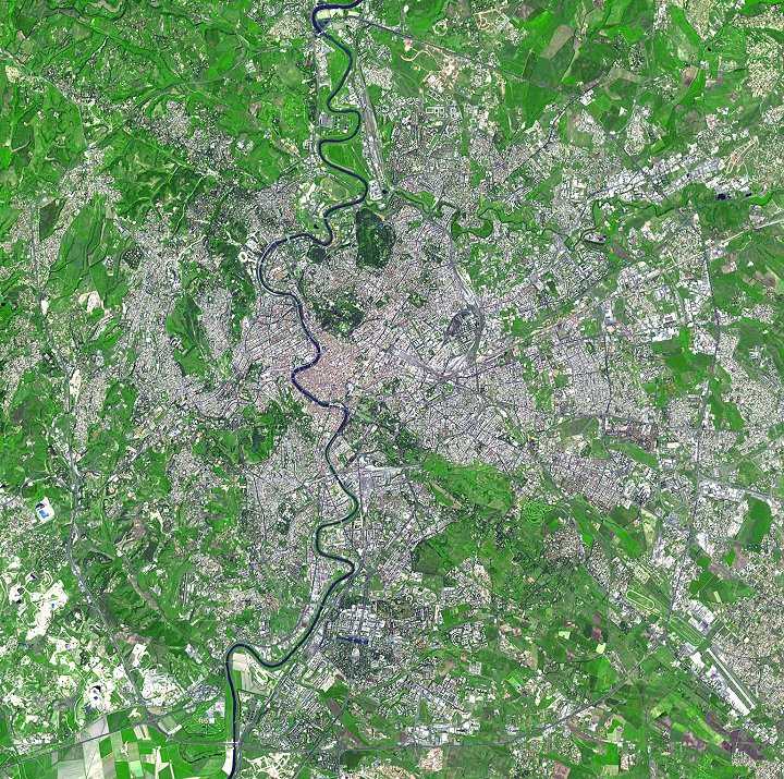
RomePosition of center of photo (Lat/Long): [41.89857/12.51194] |
|
  History permeates every corner of the magnificent city of Rome, Italy, famed as the Eternal City. Situated on seven hills along the Tiber River in central Italy - the site of settlements dating from 1500 BC - ancient Rome arose as a republic and a significant world force in the 6th century BC. The empire reached its zenith during the early 2nd century AD. The urban population swelled, aqueducts brought fresh water to the city, and a succession of emperors built splendid temples, forums, and other landmarks, including the Colosseum. After centuries of decline, the legendary city regained its cultural dominance during the Renaissance. Designated the capital of a united Italy in 1871, Rome has experienced expansion ever since. History permeates every corner of the magnificent city of Rome, Italy, famed as the Eternal City. Situated on seven hills along the Tiber River in central Italy - the site of settlements dating from 1500 BC - ancient Rome arose as a republic and a significant world force in the 6th century BC. The empire reached its zenith during the early 2nd century AD. The urban population swelled, aqueducts brought fresh water to the city, and a succession of emperors built splendid temples, forums, and other landmarks, including the Colosseum. After centuries of decline, the legendary city regained its cultural dominance during the Renaissance. Designated the capital of a united Italy in 1871, Rome has experienced expansion ever since.
|
| Source of material: NASA |
Further information: WikiPedia article on Rome
Last Update: 2011-03-30


